
|
|
|
|
TITHE AN OIREACHTAISAn Comhchoiste um Fhiontair Phoiblí agus Iompar An Fochoiste ar Údarás Abhainn na SionainneTuarascáil Eatranhach maidir le Tuile ar Abhainn na SionainneHOUSES OF THE OIREACHTASJoint Committee on Public Enterprise and Transport Sub Committee on the River Shannon AuthorityInterim Report on Flooding on the River ShannonSamhain, 2000 November, 2000 REPORTThe Houses of the Oireachtas asked the Joint Committee on Public Enterprise and Transport to consider issues relating to the management of the River Shannon. The Joint Committee appointed a Sub-Committee to consider all aspects of this matter and to report thereon to the Joint Committee. In accordance with its terms of reference, the Sub-Committee on the River Shannon decided to undertake research on the problem of flooding on the River Shannon. Consultants were engaged to carry out the research on behalf of the Sub-Committee. The Sub-Committee met with each of the bodies listed in the Appendix to the Interim Report and considered information supplied by relevant Local Authorities on costs associated with flooding in the River Shannon region. In addition, members of the Sub-Committee visited the River Shannon area in July 2000 to investigate certain aspects of the problem of flooding and during the course of the visit had discussions with a number of organisations and interest groups. The Sub-Committee now makes the following recommendations:- 1. That the Joint Committee approve and adopt this ‘Interim Report on Flooding on the River Shannon’. 2. That the Interim Report be laid before both Houses of the Oireachtas. 3. That the Joint Committee write to the Minister for Finance recommending that provision be made in the next Budget for flood relief measures as specified in this Interim Report.
Seán Doherty, T.D. Chairman. 15 November, 2000. Table of Contents
Executive Summary1.The frequent flooding of the Shannon basin causes great hardship and considerable financial loss to those affected by it. It occurs mainly due to natural causes: the very flat gradients of the river channel, the inadequacy of depths and widths in critical areas and, it would seem, increasingly intense rainfall. Accelerated siltation of the channel may also be a factor. All the evidence available, scientific and anecdotal, suggests that the problem is worsening. 2.Many reports on the Shannon have been prepared over the years. We have consulted a wide range of these reports. We have also taken submissions from interested parties. We found that the Rydell study of 1955, the joint OPW/ESB study of 1961 and the Delap and Waller study of 1988 were most apposite in relation to the issue of flooding on the Shannon. We have studied them in detail and review their findings in this report. We also, of course, had recourse to the wide range of relevant material in the submissions which we received. 3.Of the various approaches considered for alleviation of flooding on the Shannon. the Summer Relief Scheme, originally proposed by L.E. Rydell in 1955 and subsequently endorsed in 1961 by the joint OPW/ESB Report, while likely to prove extremely costly, appears to be the most promising in relation to cost-benefit and long-term practicability. 4.Before proceeding with a Summer Relief Scheme, a more detailed stage of engineering survey, investigation and analysis, to enable an updated assessment to be made of the viability of the scheme, would be necessary. That stage of survey and investigation would itself be time-consuming and costly. A modified Summer Relief Scheme would have to have regard to the changes in circumstances within the catchment since the proposal was first made in 1955, the scheme’s impact on tourism and navigation and on the environmental sensitivity of the area. 5.We do believe that an updated estimate of cost should be prepared for the scheme, together with a cost-benefit analysis of it. The updated costing could we believe involve a multiplier of around forty on Rydell’s original costings. 6.As preparatory work for a Summer Relief Scheme would inevitably extend over several years, more immediate short-term ameliorative measures would be required by those residing within the catchment. This could be provided by raising flooded roads to give on-going access to farm dwellings and by a once-off scheme of compensation. We have concluded that both these actions should be taken. 7.We have requested local authorities within the Shannon catchment to submit any available information from their records on levels and associated geographical limits of past flooding. However, the data furnished are incomplete. We believe that local authorities are the most appropriate organisations to collect such information. They should be requested to collect and furnish these details in respect of significant future flooding events. For now, government should set action in train to investigate the extent of recent flooding, and implement a once-off compensation package. 8.Evidence has been submitted to us that extensive siltation of the river and of its tributaries has occurred in recent decades and that repairs are needed to some of the hydraulic controls. These claims should be investigated, any significant problem areas identified and appropriate corrective action taken as a priority. We are not in a position to recommend where responsibility for this action should lie. We have been struck by the fragmented situation regarding responsibility for the maintenance and control of the Shannon. Accordingly we are of the opinion that we can do no more than recommend that government nominate an agency for the immediate task. We will return to this issue of fragmented responsibility and any legislative implications in our final report. 9.Bord na Mona’s turf production operations would appear to have been partly responsible for channel deposition. We believe it to be appropriate that Bord na Mona be requested to contribute to the cost of, or participate in, any necessary consequential dredging operations. The Environmental Protection Agency is the licensing authority under which Bord na Mona operates siltation ponds. More regular and stringent independent monitoring of the sedimentation pond operations should be carried out on an on-going basis and the cost of such monitoring should be borne by Bord na Mona. 10.Dedicated annual maintenance funding should be provided to any future Shannon Authority to ensure that desirable maintenance of the channels of the river and of its tributaries and of all the associated ancillary hydraulic controls is undertaken on a continuing basis. 11.Discussions should be set in train with the ESB to maximise the storage of Lough Allen and Lough Ree, so as to provide the greatest achievable buffer against the commencement of flooding. An updated survey of more recent riparian development around the perimeters of these lakes should be carried out to confirm the feasibility of creating this increased storage capacity.
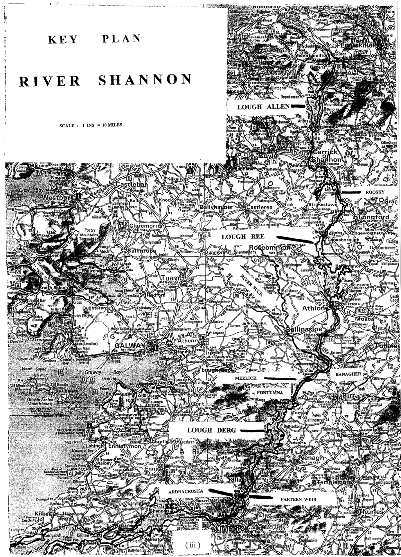
1. Introduction1.1The Oireachtas Sub-Committee on the River Shannon in meeting its obligations to prepare a report on the optimum strategy or strategies to manage the Shannon and its tributaries has decided to prepare this Interim Report on the flooding issues. In order to do so, we reviewed the following reports and submissions on the matter:- (i)River Shannon Flood Problem. Final Report by L.E. Rydell - 20 August 1956. (ii)River Shannon Flood Problem, report on first stage of investigations prepared jointly by Office of Public Works and the Electricity Supply Board, dated the 6 June, 1961. (iii)Report on technical aspects of the Shannon flooding problem for the Irish Farmers’ Association, prepared by Delap and Waller, Consulting Engineers and dated 30 May 1988. (iv)The final report of OPW, dated April 1998, on an investigation of the flooding problems in the Gort-Ardrahan area of South Galway. (v)Statement of Dúchas, the Heritage Service of the Department of Arts, Heritage, Gaeltacht and the Islands, to a joint meeting of the Joint Committee on Public Enterprise and Transport and the Joint Committee on Agriculture, Food and the Marine. (vi)Statement of the ESB to a joint meeting of the Joint Committee on Public Enterprise and Transport and the Joint Committee on Agriculture, Food and Marine on the 20 December 1999. (vii)Statement of OPW to the Joint Committee on Public Enterprise and Transport dated 20 January 2000. 1.2We have also sought submissions on the management of the river from interested parties through public advertisement and by direct request. We have had several meetings to discuss issues relating to the flooding with a number of groups, on various dates between 25 October 2000 and 1 November 2000. We have sent questionnaires dated 27 July and 10 August 2000, to the local authorities within the Shannon catchment seeking information on roads affected by the flooding, numbers of dwelling houses and their occupants and of other buildings similarly subjected to flooding, as well as the estimated cost of raising those roads above flood level. A further questionnaire, dated 26 October 2000, requesting submission of available data on past flooding levels and the extent of associated submerged areas has also issued to local authorities. We sought this information in order to frame our recommendations on short-term ameliorative actions. 2. History and Extent of Flooding2.1From the various reports available to us, it appears that severe flooding of the Shannon has occurred regularly over the last two centuries. If anything, the frequency, duration and intensity of this flooding has worsened in the last decade. It now occurs every winter and for some period every second summer on average. In winter flooding, the period of inundation can last from a number of weeks to four months and results in at least partial submergence of hundreds of holdings and flooding of around 30km of public access roads, serving up to 400 farm dwellings. It appears that the numbers of actual dwellings subjected to incursion of flood waters would be very limited. The precise extent of flooding would require to be confirmed over a period. In the most severe floods, farm dwellings can be cut off for protracted periods, being accessible then only by boat, tractor or lorry. It has been estimated that up to 50,000 acres would be regularly affected along the main channel and a further 200,000 acres on the various tributaries but these figures vary from flood to flood and are estimates only. While flooding occurs from Drumshanho to Meelick, the most severe flooding is along the twenty-seven mile stretch of the main channel downstream of Athlone to Meelick Weir. Within this length, the twelve-mile stretch from Shannonbridge to Meelick is particularly bad, but the three miles between Banagher and Meelick is most severely affected of all. Flooding commences downstream of Athlone Weir when flows there exceed 120 cub. m/sec and when water levels exceed 36.4m. O.D. Flood flows2.2For the period 1974 to 1982, flow records at Athlone indicated that the threshold flood commencement level quoted above was exceeded over 43 per cent of the time. In the severe 1954 flood, a flow of 600 cub.m/sec was recorded at Banagher and in the 1915 flood it appears that flows around 30 per cent in excess of that occurred. These figures contrast with low summer flows during dry periods of around 10 to 15 cub.m/sec. It would also appear from ESB records at Parteen that floods in 1990, 1995 and 1999 were all probably in the same order of severity as that of 1954. River channel characteristics2.3The main channel cross-section downstream of Athlone is quite inadequate to cope with other than moderate flows. From records extending between 1893 and 1955 the channel capacity over this period was exceeded over 15 per cent of the time. The effect of the inadequacy of the channel is compounded by low banks, extremely slack channel gradients and surrounding flat terrain. The overall average Shannon bed slope between Leitrim and Portumna is only around 1 in 13,000 and the lower channel over the critical Athlone to Meelick stretch is only about two thirds of that, or 1 in 20,000, which is extremely flat. Increased rainfall2.4Rainfall readings at Gort, taken in conjunction with severe but unrelated flooding in the adjoining catchment of Gort-Ardrahan in south Galway, found that the heavy rainfall there in 1959, which gave rise to serious flooding in that catchment then, was exceeded by over 20 per cent in the winters of 1989/1990 and 1993/1994 and by over 40 per cent in 1994/1995. Corresponding figures are not available in the documents studied for the very wet winter of 1999/2000, but judging by the ESB rainfall records at Parteen, the latter year’s rainfall may have been higher still. 2.5It would seem then that the very much increased frequency of severe flooding on the Shannon over the last decade is at least partly attributable to substantially increased winter rainfall. Whether this is part of a major climatic change, resulting from global warming or otherwise, or is simply a peak period within a longer weather cycle, is uncertain. If this trend were to continue, the impact of past flooding on the Shannon would be likely to be exceeded even further over the years ahead. 3. The 1955 Rydell Report and the 1961 OPW/ESB ReportReports and their background3.1Despite the considerable period of time which has elapsed since their preparation, the Rydell and OPW/ESB reports remain as the most extensive preliminary engineering investigations undertaken on the flooding of the Shannon and its tributaries. They are considered in unison in this section as the 1961 OPW/ESB Report is a more extended examination of the earlier Rydell proposals. 3.2Mr. L.E. Rydell, of the United States Army Corps of Engineers, visited the Shannon area over a thirty-day period in June to July 1955, following the major floods on the river over the winter of 1954-1955. A preliminary report was submitted by him in August 1955. A final report was then completed by him in August 1956, following consideration of his earlier report and the response to it. Both reports were largely based on desk studies, supplemented by field observations. Elements of Rydell proposal3.3Rydell advanced several possible options for alleviation of the Shannon flooding and recommended that more detailed preliminary investigations should be carried out on the more promising remedial approaches. These possibilities included:- (i)connecting Lough Gara to the Owenmore River by a proposed canal to divert surplus flood water from the Shannon catchment; (ii)exploring the possible improved utilisation of the storage capacities of Lough Allen, Lough Ree and Lough Derg, to achieve better control of flooding; (iii)providing additional storage for enhanced flood control on the river through expansion of the upper and lower operating levels on Lough Allen and Lough Ree; particular attention to be directed to considering enlarged channel outlets from these lakes, in association with improved flow control arrangements on them; (iv)possible diversion of the River Suck to Lough Ree via the Hind River or, alternatively, to divert the River Suck to a new confluence point downstream of Meelick Weir; (v)increasing the carrying capacity of the Shannon channel between Lough Ree and a point downstream of Meelick Weir; investigations to be conducted to determine the type and mass of related channel materials to be removed and the associated cost of these works; (vi)possible construction of embankments, either on their own or in conjunction with other measures, to improve channel capacity; suitability of embankments and foundation materials for this purpose to be investigated; (vii)in tandem with the proposals for the main river channel, possible improvement of the channels of the principal tributaries to be explored, including the rivers Suck and Inny; (viii)reforestation of suitable non-agricultural lands to be considered; (ix)possibility of relocation of farm dwellings, out-offices and raising of roads where benefits might not result from the above options; (x)exploring the possibility of maximising development of the fishery, wildlife, recreational and navigation potential of the Shannon, its lakes, channel and tributaries, in association with the flood control measures; (xi)following any reduction in flooded areas consequent upon the above measures, to study the possibility of improved land use and agricultural practice on the released areas. Recommended management structures3.4He also recommended the establishment of a ‘Shannon River Basin Interagency Committee’ to oversee the management of the development of the river as well as the setting up of a small specially qualified task force to monitor the design and implementation of the recommended proposals. Two stage investigations3.5Rydell further proposed that the above possibilities should be subjected to a two-stage investigation process, the first confined to minimum essential field investigations and to desk studies so that the general feasibility, magnitude of work and orders of cost of the proposals might be estimated. He saw annual costs and corresponding benefits being set out as part of a provisional overall plan. The second stage of the study would be carried out only on the more promising options, following completion of the first stage, and would include extensive field investigations, entailing geological, topographical, hydrometric and channel subsoil surveys and data collection. More detailed costings would be prepared for the schemes under consideration, as well as the corresponding economic benefits accruing from these. Joint Office of Public Works/Electricity Supply Board Report3.6In 1957 the Office of Public Works (OPW) and the Electricity Supply Board (ESB) were appointed jointly to carry out further preliminary investigations on the Rydell Report options for river diversions, channel improvements and additional lake storage. As stated earlier, the joint report of the two bodies in June 1961 is examined here in conjunction with the original Rydell Report. Proposals for Full Relief Scheme and Summer Relief Scheme3.7Two schemes were considered accordingly by OPW and ESB, incorporating what appeared to be the most potentially favourable elements of the Rydell Report proposals. These two schemes were listed as the Summer Relief Scheme (Scheme 1) and the Full Relief Scheme (Scheme 2), each giving different degrees of protection to the flooded areas. In the Summer Relief Scheme, all summer flooding in the Shannon between Athlone and Meelick, other than exceptional floods which might be experienced three to four times per century, would be eliminated. Such a scheme would also obviously improve the situation relating to the frequency, duration and intensity of winter flooding. The Full Relief Scheme (Scheme 2) would be generally similar in its scope to Scheme 1 except for incorporating more extensive channel improvements between Athlone and Meelick to carer for a flood at Banagher of 255 cu.m/sec, in contrast with the flood provision of 190 cu.m.sec in Scheme 1. both flows calculated for a water level at Lough Ree of 36.5m O.D. The Full Relief Scheme was envisaged as eliminating all flooding, winter and summer, between Athlone and Meelick and would remove summer flooding in the upper Shannon and on the Shannon tributaries. Scheme I provided similar protection also to the upper Shannon and to the Shannon tributaries. Elements of proposed Summer Relief Scheme3.8The principal works proposed for the Summer Relief Scheme were:- (i)Provision of extra storage as a flood buffer by raising the normal high water level of Loch Allen by 1.5m to give a maximum flood level there of 51.8m O.D. (ii)Improvements in the main channel between Carrick-on-Shannon and Tarmonbarry, for increased flood protection and to benefit navigation. (iii)Diverting the River Suck into Lough Ree by a linking canal to the Hind River. (iv)Enhanced control of storage in Lough Ree within the range of low water level 36.3m O.D. and the previous maximum flood level there of 39.0m O.D. (v)Improvement in the channel capacity from Lough Ree to Athlone and the drawing down of Lough Ree to 36.3m O.D., through the erection of a new sluice barrage at Athlone. (vi)The removal of the weir at Meelick and the improvement of the channel capacity upstream of this point, as far as the new sluice barrage at Athlone, to increase the channel capacity to 190 cu.m/sec at Banagher. (vii)Conventional arterial drainage, deepening and widening of tributaries to the main channel. Estimates of Cost3.9Very approximate estimates of cost were prepared for both schemes. The gross cost of the Summer Relief Scheme was estimated at £15m, at construction prices prevailing then, derived from an expenditure on the main channel of £6m and on the tributaries of £9m. The corresponding estimate for the Full Relief Scheme was £19.5m comprising outlays of £10.5m on the main channel and £9m, as for the Summer Relief Scheme, on the tributaries. To the overall estimated costs of £15m and £19.5m for the Summer Relief Scheme and the Full Relief Scheme respectively, a further £3.35m was added to the cost of both schemes in respect of drainage works already completed or in course of execution on tributaries, to arrive at an economic assessment of the benefits accruing from better utilisation of reclaimed lands under both schemes. [Since that expenditure was either already incurred or committed, it has not been taken into account at a later stage in this report, when considering updated estimated costs of both schemes.] The joint ESB/OPW reports concluded that the Summer Relief Scheme was justifiable from an economic standpoint but that the Full Relief Scheme was not. The benefit conferred by increased electricity generation and operational flexibility at Ardnacrusha was also considered in the cost-benefit analyses, but the significance of that value would have changed since that time, particularly now that production at Ardnacrusha represents only 4 per cent, or thereabouts, of the ESB’s total national generation potential. Conclusions of OPW/ESB Report3.10In its conclusions the report makes two important points - any scheme for drainage of the flooded Shannon lands must be of a comprehensive nature and improvement of tributaries alone will further worsen conditions on the main channel. Execution of works solely on the main channel would be uneconomic when compared with the value of ensuing benefits. Furthermore, increased runoff below Meelick could have considerable adverse implications for the ESB, especially in relation to the impact on embankments. In arriving at its conclusions, the report considered, but rejected, the following other additional flood improvement options:- (i)raising of Lough Ree storage to 39.6m O.D; (ii)provision of increased storage above Roosky Weir, in Lakes Bofin, Boderg, Grange and Kilglass, which would require a new weir and sluices at Roosky; (iii)use of additional riparian embankments to provide increased channel capacity; (iv)the Lough Gara Owenmore Diversion Recommendations of OPW/ESB Report3.11The ESB/OPW Report recommendation was also that the Summer Relief Scheme offered the best prospect for economic alleviation of Shannon flooding and that the scheme should be advanced accordingly to a second and more detailed stage of evaluation. This would entail field investigation and surveys, examination of channel structures, collection of additional hydrometric, engineering and geological data, confirmation of the extent of flooded areas and, of course, much more detailed costings derived from this information, accompanied finally by fresh cost-benefit analyses. A more comprehensive agricultural use survey of the Shannon basin was also seen to be necessary. As in the case of the Rydell Report, it recommended also the establishment of a ‘Shannon River Basin Interagency Committee’ and of a small specially qualified task force to oversee the detailed examination and design of the proposals. However, none of these recommendations was implemented subsequently, other than additional river gauging and rainfall recording and some localised sub-soil investigations and topographical surveys. 4. Delap and Waller Report4.1The IFA commissioned a report from the consulting engineers Delap and Waller. This report was completed and presented on 30 May 1988. Review of Rydell and OPW/ESB Reports4.2This report, prior to dealing with a number of possible specific remedial works of concern to the IFA Shannon Action Committee, re-considered the earlier Rydell and joint OPW/ESB reports. It concluded that the Summer Relief Scheme would be unlikely to proceed ‘without significant modification’. For example, lowering Lough Ree by almost 1m below its lowest water level then would have pronounced affects on navigation, lake shore developments and other works constructed since 1961. Any updated version of the Summer Relief Scheme would be subject to an environmental impact assessment and would have to have regard especially to the effects of the scheme on fishing, tourism, navigation, recreational facilities as well as on agricultural activity. Operations of Bord Na Mona4.2The Delap and Waller Report reviewed the roles and impacts of Bord Na Mona, ESB and OPW on the Shannon flooding. Bord Na Mona were stated to be the owners of 4.5 per cent of the surface area of the upper Shannon catchment and were then producing milled peat from five large bogs. It was that company’s policy to control the silt and solids content of their runoff to the Shannon to a maximum level of 100p.p.m. through provision of siltation ponds, although such basins had not been provided on their pre-1974 developed bogs. There was a potential for release of considerable volumes of fine materials from the bogs at times of high rainfall. Where siltation ponds were provided, the maintenance and cleaning of these would be vital if they were to continue to be effective. The report concluded that while Bord Na Mona’s operations may adversely affect water quality and recreational activities on the river, it did not consider that they were a significant cause of flooding. Operations of ESB4.3In relation to the ESB, the Ardnacrusha Scheme was playing a diminishing role in the overall national generating capability of the Board. The Board regulated water levels at Lough Allen, Lough Ree and Lough Derg and these controls were primarily orientated to maximisation of generating capacity but did have regard to the conflicting requirements of other interests on the river. The hydraulic controls at Parteen were capable of discharging greater quantities of water than could enter Lough Derg and therefore the Ardnacrusha Scheme itself was not contributing to Shannon flooding. The associated upstream embankments and pumping systems were effective in affording the necessary degree of protection to their dependent lands. The weir sluices at Athlone, controlling Lough Ree water levels, however, were of little benefit in dealing with flood flows at Athlone. As water from Lough Allen and from Lough Ree would take seven days and two days respectively to reach Ardnacrusha, Lough Derg had become the ESB’s primary storage, where electricity generation was concerned. The possibility of using Lough Allen and Lough Ree mainly for flood control was therefore suggested in Delap and Waller’s report. But, the extent of important riparian development, along the shores of Lough Ree particularly, would be a considerable constraint on optimising utilisation of that lake for this purpose. The report also adverts to the availability of a flood forecasting mathematical model from the ESB, which would be of significant benefit in determining the potential of greater use of Lough Allen and Lough Ree for flood storage. Role of OPW4.4At the time of preparation of the Delap and Waller report, the OPW had a responsibility for maintaining navigation on the Shannon but that has since passed to Duchas and subsequently to Waterways Ireland under the British-Irish Agreement. Now, the OPW’s sole involvement on the river relates to maintenance of a number of tributaries where past arterial drainage works have been carried out under the Arterial Drainage Act. OPW has undertaken no drainage work on the main Shannon channel itself and so has no role or responsibility for maintenance or improvement of that river. Since 1983, OPW has also shed its involvement in new arterial drainage works nationally, in accordance with revised government policy since then. It continues to operate sixty-seven hydrometric stations within the Shannon catchment and has kept some very useful records from these on flows in both the main channel and in its tributaries. Summer flooding4.5Delap and Waller confirmed that while flooding occurs from time to time, over almost the entire length of the Shannon, its greatest severity arises downstream of Athione and particularly over the stretch furthest downstream from Banagher to Meelick. They further confirmed that the flow at Athlone, above which flooding occurs downstream, is 120 cub.m./sec, which for flow records over the limited period of 1974 to 1982 was exceeded around 43 per cent of the time and, even over the summer months, was exceeded over 7.7 per cent of the time. The report points out that it is flooding within the months of March to September which has the most damaging effect on agricultural activities. In the serious flooding which occurred in August and September 1985, 2000 farmers were stated as being directly affected within six counties and up to 36,000 acres were under water, with about one third of the surface of individual farms submerged, except within parts of Westmeath and West Offaly where the corresponding figure reached 50 per cent. Examination of specific proposals of IFA4.6Delap and Waller had been requested by the IFA Shannon Action Committee to investigate a number of specific improvement measures on the river, which might lessen the severity of summer flooding. These are set out below, together with the consultants’ observations on their potential benefit and feasibility. Removal of the weir at Meelick, combined with dredging the channel immediately downstream of the weir.4.6.1.The removal of the weir at Meelick was one of the elements of both the Summer Relief Scheme and the Full Relief Scheme advanced by Rydell and endorsed by OPW/ESB, with the intention that a more detailed study of this option would be considered in the second stage of the investigations of the Summer Relief Scheme. However, the hydrometric section of OPW had carried out some investigations subsequent to their 1961 joint report on the impact of the removal of Meelick Weir, with some ancillary works, using a mathematical model and computer programme. The Delap and Waller report, after considering the outcome of these investigations, concluded that, given the consequential drop in water level which would be achieved, there ‘is clearly no engineering justification for carrying out these works in isolation, particularly as navigation in the area would be destroyed’. Re-opening of the Cloonaheenogue Canal4.6.2Delap and Waller concluded that the relationship of the canal’s capacity to the Shannon flood flows was such that the proposal had no merit. Removal of silt banks along the New Cut at Meelick4.6.3This silt bank, apparently deposited in the fifty years prior to the Delap and Waller report, was seen by the IFA as having a possible significant effect on flooding. From OPW measurement of levels of the river upstream and downstream of the bank over the period January to March 1988. Delap and Waller concluded that the removal of the bank would result in a river level drop of only around 60mm (2½ ins. approx.). Such a reduction in water level would not be significant in the context of Shannon flooding levels. (i)Co-ordination of the drawdown of Lough Allen and Lough Ree to provide earlier storage and the possibility of gaining additional storage in the lakes and (ii)Lowering of the summer navigation level upstream of Meelick from 35.4m. O.D. to 35.2m. O.D. (that is from 2.2m to 2.0m readings on the staff gauge at Banagher) 4.6.4As the two proposals had the same purpose, providing additional upstream storage to reduce the impact of late summer flooding in the lower catchment, they were considered jointly. The extra storage range considered at Lough Allen was over 0.6m and in Lough Ree the water level would be reduced from 37.5m. O.D. to 37.2m. O.D. As the additional river storage capacity generated from proposal (ii) would be filled within a half day for an increment in river flow of as little as 15cub.m/sec, the benefit would be very limited, although the callows drainage might be improved somewhat. Delap and Waller did not see this as justifying further consideration of this proposal, though the additional Lough Allen and Lough Ree storage might be of some benefit in the case of short-term minor flooding. Impact on overall river flow characteristics in flood conditions by removal of large obstructions4.6.5Long Island, immediately upstream of Shannonbridge, was specifically mentioned by the IFA as being a flooding influence and its removal was examined by the consulting engineer. Again, for moderate flow conditions, upstream and downstream water levels of the obstruction were measured and the conclusion was reached that removal of Long Island would result in a water level drop of only around 30mm (1 inch, or so). They concluded that the effect of dredging other isolated individual islands on the river would also be of limited assistance in reducing flood levels. Identification of any change in the flow pattern in the river over the previous thirty years4.6.6While detailed analysis of full hydrometric data would be necessary to form firm conclusions on this issue, the consultants found that a scanning of some of the available data did not confirm the emergence of any obvious changed flow pattern in the river. More efficient operation of sluice gates as controls4.6.7The report considered that within the available timeframe for adjustment of sluice gates, prior to the commencement of flooding, the efficiency of the limited available control could not be materially improved. Construction of embankments4.6.8The river banks on the Shannon, over considerable stretches of the river, have a significant peat content and possible intervening layers of shell marl also, on which it would be very difficult to construct stable embankments. The ESB’s earlier problems, arising from subsidence of the embankments upstream of Ardnacrusha, would be symptomatic of such a situation. However, the consultants concluded that the possibility of some localised embankment construction could be considered in conjunction with lesser channel dredging works or in association with the Summer Relief Scheme. Pumping, of course, was seen as an essential ancillary operation with any system of embankments. Drainage works on minor catchments4.6.9Arterial drainage works had already been carried out on six minor tributary catchments of the river. Others, such as the Little Brosna, Rinn and Elsin rivers as well as the Camlin below Longford, were seen as possibly offering some potential for local relief in these areas. However, the impact of consequential more rapid discharge from them on the Shannon was seen as requiring investigation before making a final decision on their value. Conclusions of Delap and Waller Report(i)The Delap and Waller Report concluded that no obvious localised engineering works emerged from their investigations which would bring about significant improvements in flood conditions in the river. However, they considered that Loch Allen levels should be operated within the full range of the limits then applying and that Lough Ree should be drawn down to its lowest feasible level consistent with navigational and riparian requirements, to provide as much storage as feasible for mitigation of the effects of summer flooding. (ii)They suggested that an approach might also be made to the ESB to undertake a comprehensive study, using their flood forecasting computer model, to assist the full potential of maximising storage on Lough Allen and Lough Ree. They also saw that the extension of the OPW computer forecasting model from Banagher to Athlone could be beneficial in providing factual information on options for flood control. (iii)They pointed out, as had others, that the ongoing efficiency of siltation controls operated by Bord Na Mona was very much dependent on proper maintenance of their settlement lagoons. (iv)As with the earlier Rydell report and joint OPW/ESB reports, the Delap and Waller findings considered that the second stage of investigation of the Summer Relief Scheme should proceed, if any progress were to be made on dealing with the Shannon flooding problems and that a corresponding special skilled task force and a River Shannon Basin Agency for integrated catchment management should be established. 5. Recent SubmissionsDúchas5.1This statement of the 20 January 2000 confirmed that Dúchas had responsibility for wildlife conservation on the Shannon and that its Waterways Service was responsible for the management, control and maintenance of navigation on the river. Dúchas was due to transfer this latter navigational function to Waterways Ireland on 1 April 2000 as part of the British-Irish Agreement Act, 1999 (which it subsequently did do). Their primary duties in relation to navigation were to ensure that there were adequate water depths for the movement of river craft. It confirmed that it operated all the weirs on the Shannon, other than those controlled by the ESB on Lough Allen, Lough Ree and Lough Derg for this purpose. It did not accordingly have control of flood water levels and so had no role in the flooding problems of the Shannon. The statement also drew attention to the major increase in the number of boats using the Shannon through Albert Lock from 3,561 in 1970 to 11,826 in 1999. ESB5.2The submission of the ESB to a joint meeting of the Joint Committee on Public Enterprise and Transport and the Joint Committee on Agriculture, Food and Marine on the 20 December 1999 reiterated its factual legal responsibilities in relation to the Ardnacrusha Generating Plant and on the Shannon lake outlet controls. It further re-stated that it was not responsible for any exacerbation of flooding on the Shannon. It stated that this flooding arose from the flat gradients of the river, the insufficiency of channel capacity over a number of critical points, as well as from the large volumes of flood water run-off. The report re-stated a number of points in relation to its activities on the Shannon:- (i)The greatest floods on the Shannon were in 1915 and 1925, before the advent of the Shannon scheme. (ii)When the water level at Lough Allen reaches a level of 49.68m O.D., the sluices are set to discharge any excess water. (iii)In accordance with a long-standing agreement with the community downstream of Athlone, the sluices at Athlone weir are closed as soon as the river levels downstream of Athlone reach 36.4m O.D. Lough Ree storage then begins to fill, reducing downstream flows. (iv)Parteen Weir controls the level of Lough Derg, the quantities of water diverted to Ardnacrusha and the discharge of overflow water to the Shannon. It can deal with maximum flood flows and can discharge greater quantities of water than leave Lough Derg. With the approach of a flood, as soon as the level of Lough Derg reaches 33.4m O.D., the four turbines at Ardnacrusha are switched to full continuous load and when the maximum operating level of Lough Derg is reached, the excess water is discharged at Parteen by opening of the sluice gates. (v)In relation to major Shannon flooding in December 1999, the rainfall gauge operated by ESB and Dúchas showed the highest readings on record there. (vi)The ESB’s controls cannot adversely influence flood levels on the Shannon. Such flooding is the result of natural causes rather than of any man-made activities or structures. (vii)At a further meeting on 25 October 2000 with our sub-committee, the ESB reiterated that Ardnacrusha, while contributing only 4 per cent to their national generating capacity, was a vital element in their production operations from the standpoint of both economical and environmental considerations. Maintaining control of Ardnacrusha and of its associated hydraulic weirs and sluices was essential to them. However, they would willingly transfer the operation of the corresponding hydraulic controls on Lough Allen and Lough Ree to Waterways Ireland (although Waterways Ireland has stated that it did not wish to assume such a responsibility). The Board officials considered that any reduction in flooding through enhanced operation of hydraulic controls on Lough Allen and Lough Ree or of the available storage within these lakes would be only marginal. This is because major flooding on the Shannon is characterised by a slow buildup of river floods and a corresponding lengthy abatement of floodwaters. They also pointed out that even at the date of the meeting the capacity of each of the two lakes had already been taken up, as exemplified by overflowing outlet weirs, even before the onset of the more severe winter flows. It was also strongly repeated by the Board representatives at the meeting that their operations on the Shannon did not contribute in any way to flooding on the river, or on its tributaries, and that their primary responsibility on the Shannon related to electricity generation. In a requested subsequent written submission of 27 October 2000, they stated that their expenditure on Lough Allen in 1999 was £15,000, in 2000 was £8,500 and that a corresponding proposed figure in 2001 is £14,000. Their submission stated that the weir and sluices at Athlone are not the property of the ESB and hence that no maintenance funds are expended on these by them. They have responsibility for maintaining the breakwater downstream of the weir, however. They did not expend any maintenance funding on it in either 1999 or 2000 but an outlay of £9,000 was proposed for 2001. OPW5.3The statement of the 20 January 2000 of the Office of Public Works transmitted to the Joint Committee on Public Enterprise and Transport was intended to clarify its current role on flooding on the river and on its tributaries. The following are its main points:- (i)Other than its statutory obligations under the Arterial Drainage Act 1945, to maintain minor catchments of the Shannon where it has already carried out such drainage works, the OPW has no responsibility for flooding on the Shannon. (ii)It has carried out no arterial drainage works on the main channel and has no responsibility for maintenance or any other aspect of the main stem. Neither would it have any future responsibility for amelioration of flood conditions on the river, unless specifically directed otherwise by the government. Heritage Council5.4In its submission of the 15 June, 2000, the Heritage Council stated that:- (i)It is not in favour of the establishment of a Shannon River Authority as set out in the Shannon River Authority Bills. (ii)A full study of the flooding causes should be commissioned by the government. (iii)Local authorities should refuse planning permission for development in areas which are prone to flooding. (iv)Compensation packages should be offered to those who are affected by exceptional flooding. (v)Roads should be raised above flood levels, where necessary. (vi)Greater co-ordination between the various agencies responsible for fish, water quality, water levels, flooding, ecology and navigation should be ensured through the requisite liaison meetings between them. (vii)Any works to alleviate the flooding should be subjected in advance to a strategic environmental assessment/heritage appraisal in order to ensure the survival of important aspects of our heritage. (viii)Waterways Ireland does not wish to take any water level control function from the ESB on the Shannon but would be happy to liaise with that body on navigational requirements. (ix)The Heritage Council would be opposed to any construction of embankments because of their adverse effects on scenery, navigation, ecology and ‘the whole water table level of the country’. (x)The destruction of the internationally important callows by removal of Meelick Weir would be unacceptable. (xi)The older bridges at Shannonbridge and Killaloe present an apparent obstruction to water flow. (xii)Dredging of deposited silt and turf dust, both on the Shannon and on its tributaries, should be considered. A study should be conducted to ascertain if dredging of islands between Meelick and Portumna would be beneficial. (xiii)The creation of a new authority for the river should not precede the full study of the flooding problem. (xiv)Surveys should be carried out of flooded roads with a view to raising them, where necessary. Roscommon County Council5.5In its submission of the 5 July 2000, Roscommon County Council proposed that there should be maintenance carried out on the Shannon channel south of Athlone and that deposited silt should be removed from there. The council believed that this would lead to a reduction in flooding. It stated that it accepted that the Shannon would not be drained. In acknowledging this fact, it proposed that once-off funding be provided to raise roads which are flooded annually. The council’s approximate estimate of cost of such work had been prepared, totaling £2.418m. An Taisce5.6In its submission of 2 August 2000, An Taisce expressed the following views:- (i)Ireland is now over-producing agriculturally and there is no longer any land use need for the drainage of river flood plains, to provide year round flood-free agricultural land. (ii)The drainage which has been carried out over most of the century on Irish rivers such as the Meath Blackwater and on many of the Shannon tributaries has been wholly destructive to their qualities as wildlife habitats, their fishing stock and their landscape character. (iii)In view of the water volume and gradient of the river between Lough Allen and Ardnacrusha, the hydrological control of the Shannon, which is in effect what drainage would seek to achieve, is not viable. (iv)A significant contribution of the current flood conditions has been caused by the draining of the arterial rivers into the Shannon, resulting in the destruction of their natural flood plains and the running of a greater water flow into the main river and lakes during heavy rainfall conditions. BirdWatch Ireland5.7In its submission of June 2000, BirdWatch Ireland expressed the following views:- (i)Improvement of drainage along the Shannon cannot be reconciled with the protection of its wildlife. (ii)The issue of drainage must be approached sensitively, while recognising that the severe floods of recent years cause considerable hardship to residents and landowners. (iii)The needs of all those with an interest in the Shannon would be better served by a serious attempt to address the practical and financial difficulties caused by flooding, than by a costly exercise in drainage which would be unlikely to alleviate the problem for landowners but could cause considerable, irreversible damage to the natural heritage of this area. Irish Farmers’ Association5.8Amongst the recommendations advanced by the IFA in its submission of the 20 June 2000 are:- (i)An overall management strategy for the Shannon is needed. (ii)All lakes and river levels must be reduced by mid-October to ensure that flooding does not take place in wintertime. (iii)The River Shannon Authority should be established, which would have sole responsibility for maintaining the river channel and required water levels, to prevent flooding. (iv)An adequate annual budget should be allocated to carry out maintenance on the main stem of the river as a drainage channel. (v)There is a need to have a financial contingency provision for agricultural losses which occur from year to year. (vi)At our meeting of 25 October 2000 with the IFA the following points were made by that association:- a)Substantial additional siltation has occurred on the river and on its tributaries in more recent years. This was, in their opinion, a major reason for the worsening flooding situation there. They were strongly of the view, since these deposits were of a peaty nature, that Bord na Mona was a major contributing agency to the deteriorating condition of the river. It was essential that this material be removed. The removed material could be deposited on riparian lands or could be used to fill disused quarries. b)On assessing the extent of flooded areas, as a pre-requisite to determination of any compensation to farmers, Teagasc or a private independent consultancy firm would be acceptable advisors. The IFA itself was not in a position to provide information on the extent of flooding. c)The association representatives considered that it was essential that the levels of Lough Allen, Lough Ree and of the river itself be reduced to their lowest possible marks prior to the onset of winter in each year, to provide a cushion against the worst flooding. Bord Na Mona5.9At its meeting with the sub-committee on 1 November 2000 the following views were expressed by Bord na Mona’s representatives:- (i)They did not accept that their organisation was, in any way, responsible for flooding on the Shannon or its tributaries. (ii)Independent monitoring of the performance of their siltation ponds was carried out by the licensing authority, the Environmental Protection Agency. That agency was stated to have expressed satisfaction that final discharges from Bord na Mona plants were in conformity with their prescribed effluent standards. (iii)They stated that a study of the river, conducted by UCC and commissioned by Bord na Mona some years ago, showed that the peat harvesting operations were not having any adverse effect on fish life in the river. During questioning by, and discussion with, members of our sub-committee the following additional points emerged:- a)Bord na Mona did acknowledge that their activities on the Shannon had contributed to past siltation of the channel. An analysis of deposited materials dredged from the river channel by them about twelve to fifteen years ago showed that approximately 50 per cent of this silt was of peaty origin. They contended that some of these peaty materials could have originated from other non-Bord na Mona bogs within the catchment, although accepting that the scale of such operations would be significantly less that those of Bord na Mona. b)While acknowledging that siltation of channels inevitably resulted in higher channel water levels, they reiterated that Bord na Mona was not responsible for river flooding. c)They had assisted about fifteen years ago in removal of deposited silt from the river bed, by providing a “Water Worker” plant unit. They would not be averse to assisting further future removal of deposited material on other stretches of the river, although expressing concern on the manner in which such removed materials would be finally disposed of. d)Their sedimentation ponds were found to be inadequate in size about ten years ago and were then greatly increased in size. e)Siltation ponds were desludged approximately twice per year. f)While there is regular monitoring of the performance of the siltation ponds, no monitoring is undertaken by the Bord on the river itself. There would appear to be little doubt but that the worsening flooding situation on the Shannon and on its tributaries is at least partially attributable to increased siltation of their channels, over the last four decades. The available evidence would also tend to indicate that Bord na Mona’s peat production plants have contributed to this position. The most critical stretches of the river where such deposition has occurred would require to be identified and early arrangements made for removal of this excess deposition, after consultation with other bodies involved in activities on the river. 6.Updated Review of Shannon Flooding OptionsIncreased flooding6.1The frequency, duration and severity of the flooding appears to be worsening, particularly over the past decade. This would seem to be mainly due to more regular intense rainfall within the catchment, as borne out by ESB records for the years 1994, 1995 and 1999/2000 especially. A further contributory cause may be on-going deterioration in channel capacities as a result of siltation on both the tributaries and the main stem of the river. However, more detailed research and records are required to establish whether the increased rainfall is the result of global warming, or is a coincidental concentration on this catchment, or possibly mainly reflects temporary peaking of precipitation, as part of a longer climatic cycle. Summer Relief Scheme6.2Of the various options which have been advanced for relief of flooding on the River Shannon and its tributaries, the most realistic comprehensive preliminary engineering proposal still appears to be the Summer Relief Scheme, as initially advanced by Rydell in 1955 and subsequently recommended for more detailed second stage investigation by the Office of Public Works and Electricity Supply Board in their joint 1961 Report. However, before commencement of this more detailed stage of surveys and investigations it would be desirable, in view of the substantial intervening period and the changed circumstances within the catchment, to undertake a general re-consideration of the initial proposals. If their current validity is confirmed, the more detailed stage should be initiated to produce a more accurate updated estimate of cost of this proposal. In advancing the scheme to this second stage, extensive consultation would be necessary with conservation groups, navigation and tourism interests and close consideration should be given to softening the adverse environmental impacts of extensive channel re-construction. Possible current cost of Summer Relief Scheme6.3In the cost-benefit analyses on the Summer Relief Scheme in 1955 and 1961, it appeared that the scheme cost could be justified by increased agricultural returns from the reclaimed land. Whether this would still be true in the light of changed intervening agricultural policies and practices, would require to be re-assessed. Moreover, it was emphasised at the time that the estimated cost of the Summer Relief Scheme was extremely tentative and was based on many assumptions and limited engineering information. Even if the estimate of £15m were accurate then, there would still be considerable uncertainty as to the corresponding current cost. However, the huge increase in environmental awareness in recent decades particularly and the major ecological sensitivity of the Shannon Basin, especially in relation to wildlife, fisheries, tourism and the natural heritage, would mean that the additional costs to minimise environmental impact would add greatly to today’s equivalent costs of the earlier estimate. Furthermore, the trebling of the navigational use of the Shannon since 1970 would introduce its own conflicting constraints of maintaining adequate water depth and the minimisation of the visual impact of any flood relief works. Today’s corresponding all-in costs, having regard to the complexity of the above factors, could well be subject to a multiplier of around forty times the original cost. The updated costing would need to be based on more reliable detailed engineering surveys, investigations and pricing. Conflicts of river use6.4There are many conflicts of use on the Shannon. On the one hand those who live and work within the catchment suffer major hardship, financial loss and inconvenience on an apparently increasing frequency, duration and intensity. They demand ameliorative action to address these problems. At the same time representations have been made by conservation groups and other interests that large drainage works should not proceed on either the main Shannon stem or on its tributaries, because of perceived major adverse potential impact on ecology, fishing, natural habitats, tourism, navigation and scenery. Instead it has been proposed that such other alternative approaches should be considered as raising regularly submerged roads above flood level, re-siting of flooded homes and compensating those who suffer regular hardship or monetary loss from repeated flooding. We recommend the adoption of these alternative short-term ameliorative approaches. Compensation should be on a one-off basis and related to identifiable losses according to clear criteria. This strategy would not appear to be at variance with the views of at least some of the local authorities. The possible cost of this approach is discussed in the next sub-section of the report below. However, such a strategy, while significantly alleviating some of the more pressing problems for the inhabitants of the catchment, does not provide a resolution of the longer-term problem of flooding of lands and associated hardship and inconvenience. Nonetheless, it does represent a significantly more rapid response to the flooding problems as it can be implemented over a much shorter time scale than would apply for a major scheme requiring extensive engineering investigations and design, protracted consultation with the many interests involved, and a very large final scheme financial input. Raising of roads6.5Estimated costs of raising roads have been prepared by local authorities for us. These amount to an aggregate estimate of £8,132,882 for the 39.9km of road involved. We asked the authorities to confirm that these costs make provision for the physical raising of road surfaces and for the following important associated costs:- (i)consequential modification required to any submerged services (e.g. watermains, sewers, surface water drainage) or to overhead lines (e.g. power, telecommunication etc.); (ii)any necessary land acquisition; (iii)all roadside boundary reconstruction or modification; (iv)revised access to properties; (v)amendments to field drainage; (vi)environmental impact alleviation. We think that it is important to note that the quality of the information supplied by the authorities seemed to us to vary and that we suspect that it maybe in some cases less than complete. The following is the breakdown of costs and lengths of roads flooded, submitted by the individual local authorities.
These costs are exclusive of any cost arising from re-location of dwelling houses or of farm outbuildings. Identification of extent of flooding6.6There is widespread disparity between figures quoted in various reports and submissions on the extent of land, dwellings and farm buildings submerged in various floods. That fact makes it difficult to establish an equitable basis for any scheme of compensation. As a minimum, it would be necessary to obtain reliable information on the acreage of land, and its location, which has been affected by the annual winter floods. We asked the relevant local authorities to supply us with this information, if they had it, for past flooding. Such composite information was not available. Accordingly, since reliable data are not available at present, we suggest that the government nominate an appropriate body to investigate, with the relevant local authorities, the situation that has obtained in flooding over the last decade. The government should then determine criteria for a one-off compensation scheme, based on the data obtained. An independent body should administer the scheme; Teagasc has been mentioned in submissions to us. In the longer term, the question of assigning to an appropriate authority responsibility for the gathering, collation and presentation of data on water levels needs to be decided. That question will be addressed in our final report. Other supplementary flood relief measures6.7It would appear from verbal and written submissions to us, and from submissions also to individual members, that extensive siltation has occurred on the main stem of the river, and possibly on some of its undrained tributaries over recent years. It has also been stated that a number of hydraulic controls on the river have been poorly maintained and are in need of repair. Investigations and surveys should be carried out to establish the accuracy of these contentions and, if confirmed, early arrangements should be made to clear this deposited material from the most critical stretches of the river and to undertake the necessary repair works. 6.8While several bodies discharge their individual responsibilities on the Shannon, no one organisation is currently responsible for such essential maintenance work or for overall control of the river. It is desirable that the task of undertaking this urgently required remedial work should be assigned to one agency and that appropriate financial provision for the work be made from the national exchequer. The necessary consultation with the various relevant organisations should be set in train at an early date to ensure that protracted delays do not occur in commencing the work. Bord na Mona should also be approached to seek their financial support for removal of river deposits, to which their activities may have contributed. It is also desirable that dedicated annual budgets be provided to undertake similar on-going maintenance work. Independently of the Summer Relief Scheme investigations, an early riparian study should be carried out around the peripheries of Lough Allen and Lough Ree with a view to establishing the feasibility of maximising possible storage on these lakes, so as to delay the onset of autumn/winter flooding even if the benefit of this additional storage would be marginal only. Consultation and agreement with the ESB would be essential for the implementation of such a proposal. 7. Conclusions and Recommendations7.1Flooding on the River Shannon now occurs over every winter and on average in one out of every two summers. It is primarily due to natural causes, the extremely flat gradients of the river channel, its inadequate depths and widths in critical areas, apparently increasingly intense rainfall and the possible effects of siltation of the river channels. It results in great hardship and considerable financial loss to those affected by it. 7.2Various engineering solutions have been advanced for dealing with Shannon flooding. The Summer Relief Scheme, originally proposed in 1955 by L.E. Rydell and subsequently endorsed in the 1961 Joint OPW/ESB Report and in the 1988 Delap and Waller Report, would still appear to offer the best practicable option of a reasonable alleviation of the worst flooding on the Shannon and on its tributaries. We see it as the most practicable long-term course of action. However, we are conscious that even though it is the most practicable proposal it cannot be pursued without first undertaking costly site investigations and surveys. We expand on this point at 7.3. 7.3Of necessity, because of the short time available for the preparation of his report, Rydell did not conduct site investigations, carry out detailed surveys or collect extensive field data. His proposal was of a preliminary nature, especially in relation to its estimated cost of £15m. He recommended that further site research was necessary before the Summer Relief Scheme could be advanced. If this scheme were to be implemented now, this more detailed stage of surveys and investigations would be essential, particularly in the light of the lengthy intervening period, the changed circumstances within the catchment and the current climate of critical environmental appraisal of such major drainage schemes. An essential element of the Summer Relief Scheme investigations would be an assessment of its updated estimate of cost and the availability of funding for the proposal. 7.4All of the above preparatory work and investigations would be likely to extend over a number of years before being completed. Such a protracted period of time, before initiation of any flood relief scheme, would be unlikely to be acceptable to the population of those flooded areas, who suffer regular hardship, inconvenience and financial loss. A much earlier amelioration of their difficulties would result from the raising of regularly flooded roads above flood level, possible re-siting of flooded farms and payment of compensation to property owners on a once-off basis, for financial losses resulting to them. 7.5It has been confirmed by the local authorities, who have prepared estimates of cost for this elevation of road surfaces, that the aggregate cost of £8,132,882 for this work is a comprehensive all-in cost to cover any associated extra works, as defined in this report. We recommend that the Minister for Finance make budgetary provision for this expenditure. 7.6Comprehensive information is not available to us on the extent of past flooding, particularly its geographical limits, numbers of houses, buildings and farm holdings affected and details of roads submerged together with information on depth and duration of immersion. This information would be essential in the determination of any equitable scales of monetary compensation to property owners. We recommend that the government nominate an appropriate body to obtain this information, in cooperation with the relevant local authorities. The government should then determine criteria for a one-off compensation scheme, based on the data obtained, after consultation with the insurance industry. An independent body should administer the scheme. 7.7Data on flooding should be gathered, as a matter of course, in respect of future floods. We recommend that this task be assigned to individual local authorities affected. 7.8In lands that are known to be prone to flooding or are susceptible to extreme weather conditions, planning authorities need to take cognisance of these matters in making and amending development plans. 7.9Claims that appreciable siltation has occurred over stretches of the river and that repair works are required on some hydraulic controls should be examined and appropriate corrective action taken, if warranted. On siltation, government should appoint one agency to undertake an immediate survey of the extent of the problem and to take early ameliorative action. Bord na Mona should be invited to assist with the cost of this work. We also recommend that more frequent and assiduous monitoring be undertaken of the operation of the sedimentation ponds, using currently accepted best practice procedures to ensure that siltation problem on the Shannon is controlled. 7.10Discussions should be initiated with the ESB to maximise storage in Lough Allen and Lough Ree, with a view to providing a greater buffer against autumn/winter flooding. 7.11A dedicated annual budget, augmented if necessary with supplementary estimates, should be provided to ensure that regular, necessary maintenance work is carried out, on an on-going basis, on the channel of the main stem, the tributaries of the river and all associated hydraulic control structures and installations. |
||||||||||||||||||||||||||||||||||||||||||||||||||||||||||||||||||||||||||||||||||||||||||||||||||


|
|||||||||||||||||||||||||||||||||||||||||||||||||||||||||||||||||||||||||||||||||||||||||||||||||||